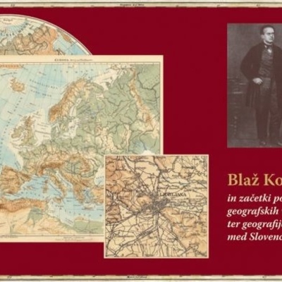
January 24th, 2021 marked exactly 200 years since the birth of one of the most renowned European cartographers and geographers. He was born into a modest farmers family in Hotunje near the town of Ponikva, in what is today the municipality of Šentjur, the same year the famous Congress of Ljubljana took place. It was that same year that man set foot on Antarctica, the final unexplored continent, and the maps of the world got their current shape. During the fifty years of his life (he died on May 29th, 1871 in Vienna), he walked an interesting path that took him from a talented boy to a priest, gymnasium professor, and, finally, one of the most prominent scholars of the Habsburg Monarchy.
Like Slomšek, Kocen also became a priest and worked as a vicar in several towns and villages of Lower Styria. One of the outcomes of the March revolution was a thorough overhaul of gymnasiums with several new subjects being introduced (including geography). Kocen seized the opportunity and became a substitute teacher at his former gymnasium in Celje, where one of his students was Mihael Vošnjak. He continued his studies to become a gymnasium professor in Vienna, where he was classmates with Gregor Mendel, the father of genetics. He got his first full-time job as a professor at a gymnasium in Ljubljana, where Dragotin Dežman convinced him to join the Museum Society and sparked his interest in the young field of geography, which had just recently started to make its way into the University of Vienna.
His pupils (Fran Erjavec etc.) and colleagues described him as a man who always carried a geography book. He once wrote that of all the subjects taught at schools during that time, geography was the most “under-privileged” when it came to learning tools. Due to his breathing problems, he was transferred to the gymnasium in Gorizia (one of his pupils there was Simon Gregorčič), where he studied the climate of the area and published his first science book in 1857. The very next year, he published his first geography textbook and left for a new job in Olomouc in Moravia.
He started working with Eduard Hölzel and together they brought his publishing house to the forefront of cartography and school geography of the Habsburg Monarchy. In 1861, after publishing several successful geography textbooks and maps, they published his first school atlas, which is still around today and is the oldest school atlas in the world. It’s still being published in Austria, Italy’s South Tyrol, Israel, and Bulgaria. To this day, it has maintained its reputation as a high-quality, up-to-date, and easy-to-use learning tool, which was named the best in the world a few years back by the ICA (International Cartographic Association). It has been reissued almost 300 times in six different languages, with eight countries on three continents publishing licensed editions.
One of the major improvements of Kocen's atlas was the inclusion of larger geographical regions, such as those displayed on the two-page maps of the Mediterranean and the Alps. He added a bilingual table of place names in Slovenian and German languages to his map of the Alps, a clear sign of his patriotic pride. He was also very careful about his scales being comparable, the accuracy of toponyms he used, and the places of historical importance displayed on his maps (geography was still taught together with history in those times). He based his teaching on the didactic principles of observation, research, experiments, clearness, understanding of maps, gradual learning, and the “near-to-far” principle, all of which are still being used today.
Kocen’s work has an important place in the history of Slovenian education, as well as the Austrian, Czech, and Hungarian cartography. With his efforts, he set an example of useful and accessible learning tools adapted to classroom use. Even later German atlases followed his lead. His contribution to the development of education has been acknowledged as far back as 1863 when he became a member of a prominent school council led by Fran Miklošič, which pushed for geography as an independent school subject. The hard-working and successful years in Olomouc, however, had a major impact on his deteriorating health. As a result, he retired in 1870 and, together with the Hölzel publishing house, moved to Vienna where he died "with a sketch map in his hands".
His birth house in his home village was torn down in 1967 and a partially reconstructed memorial room was built in its place thanks to his relatives, the Debelak family, who are in charge of Kocen’s former property. The local tourist office in Ponikva helped set up a retrospective exhibition there just over a decade ago, and a monument was erected in 1972, unveiled by Dr. Svetozar Ilešič.
Kocen’s compatriots had already acknowledged his achievements as far back as 1898 when a memorial plaque was put up at the school in Ponikva. Today, the plaque can be seen at the modern memorial pavilion in the village centre of Ponikva, together with a plaque dedicated to Slomšek. To mark the 100th anniversary of his birth, another memorial plaque was put up at his birth house. Today, it can be found at the Blaž Kocen Primary School in Ponikva, which, together with the local tourist office and the Slovenian association of geography teachers, has been organizing a traditional event in Kocen’s honour each March for over a decade. The event includes a hike along the local educational path and several geography lectures.
One of the leading figures of European cartography was held in high regard by Slovenian geographers of the 20th century, as well as their Austrian colleagues, which was clearly evident at the 150th anniversary of the publication of his first atlas. The Austrian Academy organized a major event attended by more than 200 people and the speakers included the manager of the Hölzel publishing house, the president of the Austrian National Council, the Austrian minister of education, and Dr. Jurij Kunaver, a representative of Slovenian geographers. But two of the most active individuals instrumental in preserving his memory during the last half a century have been Slava Kovačič, a geography teacher from Ponikva, and Dr. Jurij Kunaver, a retired didactics professor at the Department of Geography at Ljubljana’s Faculty of Arts. Since 2001, the Slovenian association of geography teachers has been awarding the Kocen Award for lifetime achievements in the field of geographical education. During the last couple of decades, several monographs, scholarly works, and scientific publications have been published about Kocen and his work. Slovenska matica, Slovenia’s oldest cultural and scientific association, organized a two-day international symposium, and the Slovenian School Museum organized an exhibition on Blaž Kocen.
In March 2021, the municipality of Šentjur joined forces with the Blaž Kocen Primary School, the Ponikva Tourist Office, the Association of Slovenian Geographers, the association of Slovenian geography teachers, and the three major Slovenian universities; together, they planned a two-day symposium along with an event called Kocen’s Saturday, both of which were postponed to September due to the corona pandemic. Leading European experts in the fields of didactics, geography, and cartography will try to shed some light on various aspects of geography lessons in the past, present, and future, all based on the basic didactical principles established by Blaž Kocen.
ROŽLE BRATEC MRVAR


